GPS is not available at all places.
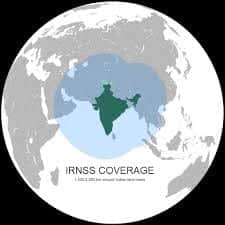
Signal is weak in remote areas but our own signal will be available in remote areas with better accuracy.
Monitoring and effective management of fleet of trucks or ship monitoring will be done through spacecraft.
For example, for ships the system can inform which route will be more effective.
That will save time and fuel, he said.
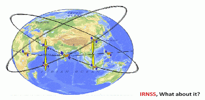
IRNSS is needed because the foreign government-controlled global navigation satellite system does not guarantee service in all situations.
Restricted Service (RS) This is an encrypted service that will be provided to authorised users only.
Meanwhile, the ISRO organization is hoping to get the IRNSS fully operationable by next year July.
As per the official, the so-called IRNSS will provide location accurately to almost 20 meters.

This data from IRNSS can be used in all the devices, which supports the additional hardware.
As we make it global, global users will be able to take advantage.
And It Will Be Better than GPS.
source: www.techworm.net
